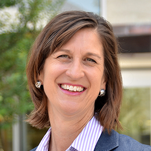
From curriculum to case competitions, Supply Chain Professor Laura Meade shares how blending geographic information systems (GIS) with business acumen can strengthen supply chain solutions and support global sustainability.
November 04, 2021
By TCU News
TCU will be a location host November 17 to the growing GIS Day. The worldwide celebration is centered around discovering the world through geographic information systems, a scientific framework for gathering, analyzing and visualizing geographic data. The data is used in the public and private sector everywhere for everything from mapping sewer lines to analyzing populations to calculating your Amazon delivery route.
Involved in TCU’s third annual GIS Day are Esri, a leading spatial analytics company and founder of GIS Day, and corporate partners Dunaway Associates and HEB. The panel also includes a cross-discipline representation from TCU, including Professor of Supply Chain Practice Laura Meade from the Neeley School of Business; Assistant Professor Esayas Gebremichael from the College of Science & Engineering; and Associate Professors Sean Crotty, Xiaolu Zhou and Kyle Walker from the AddRan College of Liberal Arts.
Meade answered a few questions on how GIS is being used in the Neeley School of Business.
How have you used GIS in your classroom?
I am using it for the first time this fall as we are continually updating courses and implementing analytical tools. GIS fits well with my Global Supply Chain course, and, with assistance from Esri – our partner and leader in GIS technology – we have developed an intensive project for students in the Global Supply Chain course. They begin by analyzing and understanding why electric vehicle maker Tesla located their factories around the world. Then, they are given three new countries to consider and, through a variety of map layers and business analyst tools within GIS, they will develop their own recommendation.
Can you speak to how else GIS is being used in the Neeley School of Business?
We have used GIS the last three years in our TCU Graduate Supply Chain Case Competitions in conjunction with our partner companies who currently use GIS. Case competitions are where students from multiple business schools compete to propose a solution to a company’s challenge or business decision. These have included Nike, Chick-fil-A and BNSF Railway. For instance, the BNSF competition involved GIS to solve identifying new areas for BNSF to place new logistics centers as it expands its network and the ability of its customers to access rail lines.
Have you used GIS for any cross-discipline efforts at TCU?
We are beginning to have discussions around this. This year’s GIS Day – celebrated at the Neeley School of Business for the third year – features a cross-discipline panel that will show how GIS is being used in the AddRan College of Liberal Arts and the College of Science & Engineering. I think that will be a solid start to these efforts.
What do you feel is next on the horizon for GIS at TCU?
More and more students will be exposed to the analytical software. It really is infiltrating so much – supply chain, but also neighborhoods and geography and education. I also see it playing a big role in solving global issues such as sustainability. I think it will be fascinating to see where it goes.
Read more about how GIS is being used at TCU in the AddRan College of Liberal Arts and the College of Science & Engineering.